Places
20 places found.
Those places high-lighted have photos. All locations may have maps, books and memories.
- West Park, Cleveland
- West Park, Sussex
- West Park, Merseyside
- West Park, Humberside
- West Park, Tyne and Wear
- West Park, Yorkshire (near Horsforth)
- Goldthorn Park, West Midlands
- Friar Park, West Midlands
- Ashmore Park, West Midlands
- Park Village, West Midlands
- Rotton Park, West Midlands
- Ettingshall Park, West Midlands
- Selly Park, West Midlands
- Whitmore Park, West Midlands
- Summerfield Park, West Midlands
- Woodway Park, West Midlands
- Four Oaks Park, West Midlands
- Lime Tree Park, West Midlands
- Park Street, Sussex
- Queen's Park, Cheshire
Photos
42 photos found. Showing results 121 to 42.
Maps
36 maps found.
Books
Sorry, no books were found that related to your search.
Memories
456 memories found. Showing results 61 to 70.
Siv's
I am a West Gorton lad from the 50's. Gregory street between Thomas street & Clowes street, I thought I lived in a 2 up 2 down but apparently now it was a bijou victorian conjoined cottage with sort after features. I attended Thomas ...Read more
A memory of West Gorton by
School Days And Beyond
Having just stumbled on this website I felt compelled to add my recollections of living in Fenham in Cheeseburn Gardens from circa 1961 to 1980. I lived 2 streets down the hill from the first contributor who lived in Ovington ...Read more
A memory of Fenham by
Memories Of Southall
Lived in West End Road from 1960 to 1969, my brother was born there in 1961. We both attended Beaconsfield Road Infant School. My teacher for the first 3 years was Mrs Blong, our headmistress was Mrs Goodall. Have many happy ...Read more
A memory of Southall by
Year Of 1959
My grandmother came from Shepton Mallet and left to live in West Yorkshire. I came to live for a short while and attended school out on Charlton Road. The house I lived at was the last one on Waterloo Road at its junction with ...Read more
A memory of Shepton Mallet by
East Ham Memories
I was born in Plashet Grove in 1951 but shortly moved to 146 Milton Avenue until moving away from the area in 1967. So many memories. Happy days playing in Plashet Park, 30 a side football in Milton Avenue with a case football ...Read more
A memory of East Ham in 1951 by
Hounslow 1970's
I was born in West Mid Hosp and we lived in Worton Way which was technically Isleworth but very close to Hounslow High Street. Our surname was Pritchett. I went to Spring Grove Infant School in Star Road from 1962-1969 and then ...Read more
A memory of Hounslow by
Childhood Memory
I recall moving house from the Spike, Blaydon, to a newly built house in Linden Road, Blaydon. The steps leading down from the gateway where not quite finished so my Dad had laid wooden planks down so my mum could get down to the ...Read more
A memory of Blaydon in 1955 by
1975 Till 1995
I grew up in Noggsy during the 70s 80s - Glassonby Cres, Rushmere Rd, Lewisham. All the places we could of been, Norris Green was the best. St Tessys School vs Welly Broard Sq vs every one else. We overcame addiction ...Read more
A memory of Norris Green in 1870 by
Thatcham 1951 1962
The shop opposite the White Hart public house, owned by Simonds, was called Lays Stores. My mother and father bought it in 1952 and ran it till it closed in 1962. Before that, they owned the fish and chip shop which has now ...Read more
A memory of Thatcham by

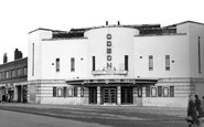
The Odeon
I remember going to The Odeon on Saturday mornings with my cousins. My family lived in Stephenson's Way then before we moved to Chelveston Drive. It was a long walk from what was The Lodge Park Estate and we'd go in a gang and replay the ...Read more
A memory of Corby in 1950 by
Captions
191 captions found. Showing results 145 to 168.

The 500 acres of deer park was incorporated in the city boundaries in 1932, but only the east side, a strip along the north side, and a strip along the west side were developed for

Here we see two horse-drawn narrow boats, the 'Linnet' and the 'Evelyn', belonging to George Garside, at the attractively sited lock in Cassiobury Park, Watford.

In the 1920s, Tom Richmond's West End Boating Stage offered rowing, Canadian-style skiffs and punts.

At the top of the glen a pioneer amusement park was established from 1887 when the switchback railway from the Saltaire Exhibition was moved up the hill.

The Phoenix and the attached shopping precinct to the west of the modern town centre are typical examples of the late 1950s to early 1960s New Town expansion.

On the level ground to the south-west of the town stands the almost ploughed-out remains of an ancient double-ditched camp called The Aubreys.

West of Bruton, Castle Cary is set on the side of the oolite hills of southern Somerset, with Castle Cary Park on Lodge Hill rising steeply behind the church.

Worcester Park is situated north- west of Sutton along Malden Road.

Now around to the south-west side of Glastonbury, where Wearyall Hill lies between the town and the river Brue.
South Road was, and still is, the main east/west route through the town, passing St Wilfrid's Church and Victoria Park with distant views of the South Downs; it encouraged en route travellers

There is still a bank on the corner, but the market cross of 1790 is now located to the right of the square, after standing in the park opposite between 1968 and 1986.

Among those already occupied or well on their way to full occupation are the prestigious West One and Royal Plaza developments in the fashionable 'Devonshire Quarter' around West Street and upper

Rothley lies some five miles to the north of Leicester, and to the west of the busy A6.

In the1920s Jesse Boot, founder of Boots the chemists, gave land to the west of Lenton, and University College moved here out of the city centre.
The town now forms part of the Borough of Dacorum, a name of Danish origin.

Protected from overwhelming traffic by the encirclement of the Upton by-pass to the west and the M53 motorway to the east, Upton has changed little since these views were taken.

Leaving Daventry on the west-bound turnpike to Warwick and Stratford upon Avon we arrive at Staverton village.

We are looking south-west from the Memorial Park; John Street and St Anselm`s Church and school are behind Market Street.
Rothley lies some five miles to the north of Leicester, and to the west of the busy A6.
Houses were built on most of the remaining available land - this was mainly between Park Road and Sandy Lane; to the north and south of the High Street; and along Fairfax Road.

Preston was always a town that you had to pass through to go north to south, but as the popularity of Blackpool increased, so did the traffic east to west.

Protected from overwhelming traffic by the encirclement of the Upton by-pass to the west and the M53 motorway to the east, Upton has changed little since these views were taken.
The modern day High Street running from the steps leading to the west door of the church shows the medieval settlement from the 1200s.

The land for this park, west of the GWR Village, was donated in 1844 by Colonel T Vilett, one of the major landowners in the area, for the use of the railway community as a cricket ground and
Places (20)
Photos (42)
Memories (456)
Books (0)
Maps (36)

