

Revised New Series Maps of the UK

Revised New Series Maps are available to buy as follows:
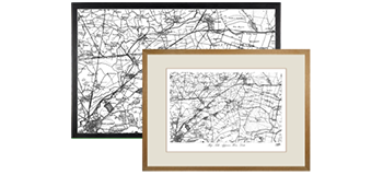
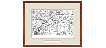
Your chosen historic local map printed to order. Framed, Mounted, Print Only or on Canvas.
Add a personal dedication within a framed print to commemorate a special day or event.
Explore the Revised New Edition Series
Originally surveyed 1842-1893 and Revised 1893-1898. Scale is 1:50,000.
The late 19th-century was without doubt the age of the railway, and the Revised New Edition is the definitive record of its glory years. Another, quieter, technological revolution was also taking place at this time: the development of colour printing. Information could now be displayed in more subtle and varied ways, and at a reasonable cost. The government, the military and, increasingly, the public were demanding that the map-makers responded to this.

The growth of the railways
In February 1804 the Cornish engineer Richard Trevithick, in order to win a bet, built and successfully operated the first steam locomotive to run on rails. He was unable to capitalise on this achievement and it was left to others, notably George Stephenson, to refine and develop this new technology over the next 20 years. The result was a railway-building boom that was to transform the country.
Fewer than 100 miles of track existed in 1830; this had grown to 1,500 miles by 1840, and to 10,400 miles by 1860. This revolution helped drive Britain’s increasing prosperity and industrialisation during the rest of the century, and contributed to numerous social changes including the growth of trade unionism, the advent of tourism and the standardisation of national time.
Railways enabled goods and people to be quickly transported to and from large towns and cities, so hastening the existing trend towards urbanisation. In 1800, around 75% of the population had lived in the countryside and the rest in the towns; by 1880, these proportions had been reversed. As a result, many long-familiar aspects of the landscape were changing for good – and changing far more quickly than they could be mapped.
The "New Edition" (surveyed 1842-1893)
The government and the Ordnance Survey took several measures to address this issue. From the 1840s surveys were carried out at increasingly detailed scales and were used for many purposes including railway construction, geological survey and sanitary reform. In order to ensure complete and accurate coverage, the 1841 Survey Act had already given surveyors the right to ‘enter into and upon any land’ in the course of their duties. Having moved into new premises in Southampton after a fire in 1841 had destroyed their overcrowded Tower of London headquarters, the Ordnance Survey, armed with its new powers and instructions, began work on re-surveying the country. The results, published at the one-inch scale between 1876 and 1896, were later to be known as the New Edition.
The Revised New Edition (surveyed 1893-1898)
In 1893 a more thorough revision was undertaken which resulted in the publication of 346 sheets, between 1895 and 1899, of what became known as the Revised New Edition (later sheets were merely the same with hachured hills added). Improvements in reproduction and printing techniques helped these to be even clearer and more accurate than their predecessors. By this time, however, another change was being demanded; for from the early 1890s, the military was pressing for a one-inch map in colour. Financial, technical, aesthetic and political considerations as to how this could best be accomplished were hotly debated between the numerous interested parties.
The Revised New Map Edition is an immaculate record of a vibrant society on the threshold of a still greater period of development and urbanisation. It records countless reminders of the past, many of which were about to be swept away for good. For local historians, this is the final record of your part of the country before the changes brought by the motor car. If your interest is genealogical, the Edition coincides with the 1901 Census, showing the landscape your ancestors inhabited. Whatever your reason for being interested in your area’s past, prepared to be entranced by these maps – enlarged and combined to match the present-day OS Landrangers, they will reveal secrets of a familiar landscape you never knew existed.
What people say:
Added 24th April 2019
“I just wanted to say thank you for your help and for the excellent service provided by Francis Frith - my order arrived yesterday, so much sooner than anticipated, and it looks fantastic!”
Added 2nd April 2019
“Order received today. Beautiful!!
Thank you for the swift and excellent service ”
Added 16th March 2011
“Just a quick line to say that I received my framed historical map today and it is utterly wonderful. The gallery style frame is perfect and everything is just how I wanted it. Many thanks for a job well done”
Added 16th March 2011
“This is just a huge thank you for the impressive framed map I received yesterday. The recipient of this gift will be delighted I am sure. Thank you again for your great service”
Added 16th March 2011
“Just to say a big thank you for the quality of the map I ordered from your company for a Christmas present. I was really pleased with it but was concerned I might not have enough wrapping paper left over- then what did i find but paper & gift tag included.
I am a very satisfied customer
Happy New Year & thanks once again to everyone concerne”
Added 16th March 2011
“I am writing to let you know how delighted and impressed I am with my historic map of the above address. It has provided me with a fascinating insight into my local area and looks particularly delightful in its frame. Thank you very much”
Added 16th May 2017
“We received the package yesterday and we LOVE it. Thank you to you and your team on working with me on this and being so easy to work with to make sure I got what I wanted. The canvas was perfect, the writing clear and the map with the buildings marked is great. Turned into the perfect birthday gift which I had hoped for.”
Added 4th November 2021
“Many thanks for this order - a fascinating set of four OS maps for our area going back 200 years. Lots of interesting comparisons to be made!
Kind regards,
John”
Added 5th September 2018
“Hello Andrea
Just a quick note to thank you and your team for your speedy and considerate service. I ordered a map print and explained to you that I really wanted it by this coming Friday as it is a special gift. You dealt with my order with the utmost professionalism and assured me it would be delivered by Friday. It came today. The print, the mount and the frame are exactly as I expected.
I am really impressed with your company’s service. Thank you.”
Added 28th November 2017
“Hi Andrea,
Success! All maps have just arrived and they are perfect!
Thank you so much for sorting this for me. Dad will be so pleased.
Many thanks,
Sara”
Added 19th December 2016
“Excellent map with which we are absolutely delighted. Unbeatable service. Helpful customer service from Claire and Andrea. I have no hesitation in highly recommending Francis Frith. It is our second purchase and we will definitely be buying more :”
Added 29th August 2020
“ I wanted an old map of Stoke Gifford, near Bristol for my husband's birthday. So l ordered an 1880 map from Francis Firth. I did pay for express delivery but I didn't expect it to arrive the next day! We are really pleased with the map which clearly shows our house. The framing is really good. The ordering process on the website was slick allowing you to see the various options for the mount and fram”
Added 16th March 2011
“I have been out and just returned to find my map in my office. Thanks for a great service at Christmas, best wishes for the festive season and a happy new year
I have been out and just returned to find my map in my office. Thanks for a great service at Christmas, best wishes for the festive season and a happy new year.
I have been out and just returned to find my map in my office. Thanks for a great service at Christmas, best wishes for the festive season and a happy new year.
regards, Richar”
Added 16th March 2011
“Just a quick thank you for the lovely framed maps - even better than I imagined they would be. One for my son and daughter in law for their new home in Wales, and one for us in Northamptonshire. They are fascinating and show how much places have changed over the years. Again thank you so much - excellent service and prompt delivery”
Added 29th April 2013
“We have just heard from our friend, who has received his map, and is over the moon. He is retracing all the steps of his youth, looking up the streets where family and freinds lived - just what we hoped! Thank you so much”
(This will navigate you away from this page)